--from Dawn, September 2015--
This page is about the trip that we have done many years, beginning sometime in the early 2000s, when Dawn's coworkers invited her on a day hike at Arroyo Seco. The trip has expanded to a hop, stumble, and swim along 11 miles of river gorge over multiple days. Most of ABLs friends have probably heard Rob describe this trip before, probably on multiple occasions. For the lucky few who have missed out, here's the deal.
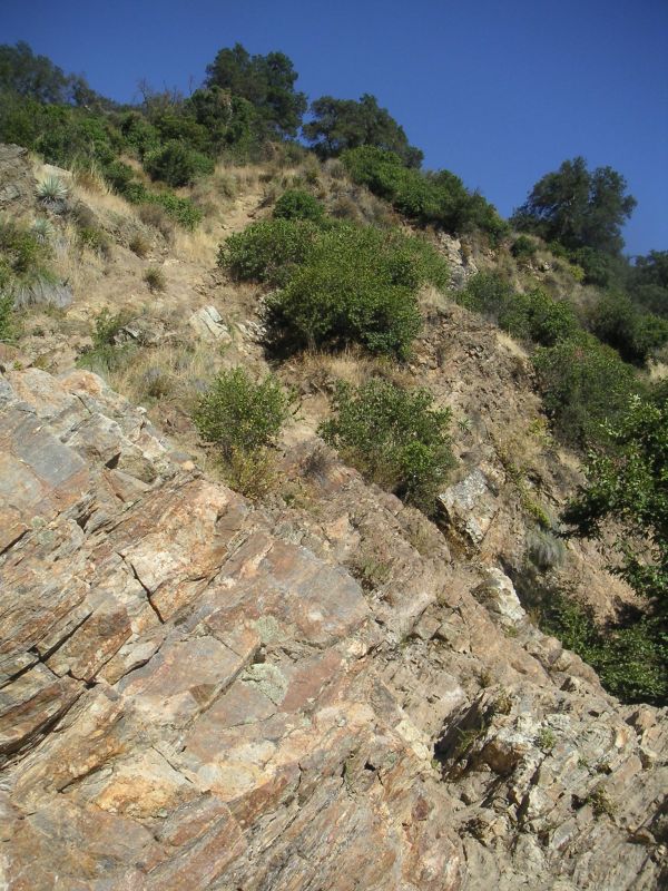
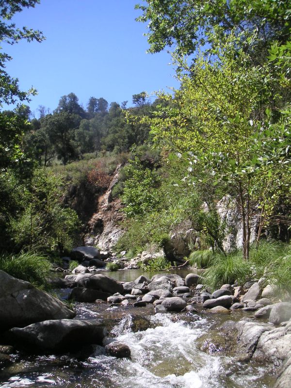
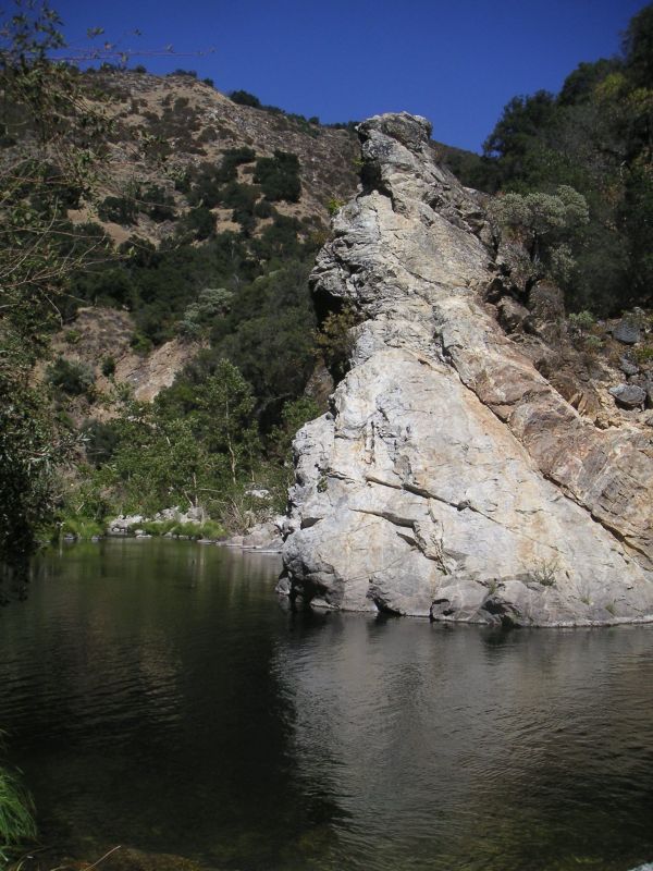
The Arroyo Seco is a small river which has its headwaters in the Ventana Wilderness, west of Soledad. The river is accessible from two trailheads, one at Escondido Camp (dry campground), and one at Arroyo Seco Campground. Between these two access points the river is largely inaccessible for about 11 miles or so. Traveling down river is about a third on land; walking, climbing, or hopping rock to rock. Another third is swimming. The remaining third is walking on slippery rocks under a foot of water. None of this terrain affords particularly fast travel. Along the way, there are opportunities for jumping into deep pools from great heights, enjoying beautiful waterfalls, and getting a bad case of poison oak.
The other complicated part of this trip is that, though the trailheads are not far apart as the river flows, the drive between the two is almost two hours long, including going through Fort Hunter Liggett. In order to not be stranded, we've parked cars at both trailheads, and done a silly amount of driving.
The first two years (July 2004 and August 2005), we did this trip in two days. The third year, we spent three days and two nights on the river. The fourth year, we reversed the trend of getting successively slower each year and finished in two days with time to spare. The extra speed has been attributed to three factors. First, the water was the lowest we had seen in the four years. This meant slightly more hopping rock to rock and slightly less slipping along in a foot of water. Second, everyone was well prepared for the trip. Third, we got a really early start the first day, thanks to Eagles.
In July 2007, we tried what's called a Turkey/Eagle Split. Everyone drove to Escondido Camp on Friday evening. From there, we split the group into two parties, the Turkeys and the Eagles. The Turkeys got up at the crack of dawn and started hiking down the gorge. The Eagles had a leisurely morning at camp before driving the cars to Arroyo Seco Campground, where they spent the next day and a half going on day hikes, swimming, taking naps, eating cake, and visiting the amenities, complete with indoor plumbing. The Turkeys stumbled down river for two days in the hot sun, and slept at night on a small patch of sand between the poison oak and the river; there were no toasted marshmallows. Turkeys and Eagles were reunited Sunday afternoon at the wilderness trailhead, where there was much rejoicing and tale of adventure.
June 7, 2008 we attempted to go earlier in the season to get higher water levels. We ended up turning around after a morning of hiking, because we were all too cold, and worried about getting hypothermia. It turned out that it was a good thing we left, because a fire started in the area that same weekend.
2011 was the "high water year", with 65 cubic feet per second flow. Downright dangerous, and everyone came back quite beat up and bruised, but thankfully all in one piece. Ropes abandoned to climb around the waterfall, since it was otherwise impassable.
In September 2015, we made a Turkey/Salmon Split. With a large number of participants, we were able to have two parties, the Turkeys and the Salmon. Salmon would swim upstream from Arroyo Seco Campground, Turkeys would meander their way down from Escondido Camp. This meant that, with careful planning and car-swapping, each group drove directly to the trailhead where they were going to begin, met along the river to exchange car keys, and finished at their own car preemptively packed with a change of dry clothes and light, crispy snacks. Since the upstream route was unknown to us, we budgeted three days. Turns out, the Salmon finished in two, despite wandering up Lost Valley Creek. Luckily there was an NPC there to send them back to the scripted part of the adventure, which they finished out with much inhaling of bugs. Turkeys took their dilly-dallying to heart, and spent three days, with leisurely mornings and rock-skipping breaks.
At the end of August 2017, we did a Boomerang itinerary, where we started at Arroyo Seco gorge parking, hiked to the horse bridge, went upstream past the waterfall, and spent some time jumping into the yin-yang pools. We headed upstream to camp Saturday night, but the prime sandy spot was already taken by a group who was surprised to see us. We ended up camping a bit further upstream, past a few more pools. We came back down on Sunday, and chose to take the standard adventure, exiting the river at the horse bridge and taking the well-graded, dry, fire road to the cars. It was ridiculously hot (like 103F)! The ranger came by and offered us water and gatorade, probably trying to reduce the chances of us collapsing of heat exhaustion and dehydration, and having to rescue us... at least we were already on the road, so access was easier.
(top)Properly equipped for this trip is unlike properly equipped for any other trip I've done. Here are the things that have worked well and some things to avoid.
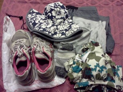
Footwear:
I'll be wearing thick hiking socks and running shoes. Tevas and other water-friendly sandal type shoes are strongly discouraged. You really want shoes with protection for the sides of your feet. Your feet will do a lot of sideways sliding on rocks and into other rocks. The first hundred times your feet may be able to take it in sandals, but eventually you'll likely slow down so you can keep from slipping. I've not tried hiking boots, but they seem like maybe they'd be hard to swim in.
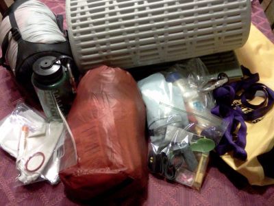
Pack:
You really want a pack which doesn't get noticeably heavier when it gets wet. I've seen two solutions to this. Pack into a drybag or pack into a mesh bag. This trip does not require a large volume of equipment, so you can get away with a pretty small pack. It's preferable if your bag has comfortable straps, but a light weight bag with improvised webbing straps will also work. Dry bags make useful flotation devices.
Stove:
You really don't need a stove.
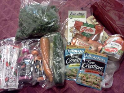
Food:
The supermarket is full of vacuum sealed or otherwise waterproof single sitting sized pieces of food. I plan on bringing only this type of food. Cheese, salami, Gogurt, tuna (in a pouch not a can), cucumber, carrots, apples, baby food (in pouches), jerky, dried fruit, and granola bars are some things I recall eating in past years. Also, swedish fish.
Sun protection:
I like Bullfrog waterproof sunblock. People have also used AloeGator and one with a Surfing Badger. I also wear UV blocking goggles and a sun hat.
Clothing:
Here's an area you can skimp a bit on. One year I wore only a bathing suit, though I did get chafed by my pack straps. Several years I've worn a bathing suit and a synthetic long sleeve shirt and was pretty happy. Being soaking wet most of the day means that you don't want cotton or any other fabric that will absorb water.
Shelter:
This is one I have trouble advising on, since I'm a pretty warm sleeper. Here's what I've tried. (all of the below were with a RidgeRest sleeping pad and a fuzzy hat)
Polar fleece sleeping bag liner: Too Cold
Winter sleeping bag: Too Hot
Light weight travel bag (rated for 55F): A Bit Chilly
Light weight travel bag with emergency blanket: Just Right
I was really blown away by how much of a difference the space blanket made and really recommend using one. People have brought tents, but I think that they are not worth the weight for what is likely to be reasonably warm weather.
Map, Rope, First Aid, Water Purification:
I'll bring enough of this to share but I love to have redundancy in the first aid and clean water departments.
Sample gear, food, clothes:
--from Dawn, September 2015--
Dawn and Rob did a scouting trip on Sunday, August 6, 2017 and checked out the 20ft^3/s flow situation. The current was quite lovely, and not at all scary. Swimming upstream the last 10 feet to the base of the waterfall is challenging but doable.
Other things we learned:
Hiking to the horse bridge takes an hour along the fire road. It took 2 hours for two unencumbered people to get from the horse bridge to the waterfall in the river. The last swim took 10 minutes.
On the way back to the horse bridge, we counted "deep pools". There were seven (formerly counted as eight) deep pools between the waterfall's pool and the horse bridge.
Hey, how deep does a pool have to be before it's a deep pool?
You know it's a deep pool when the tallest member of your party cannot stand and keep their nose out of the water in the deepest part. Other fiddly bits of definition: a long pool with two deep areas connected by a shallower section is considered one deep pool if you can swim through the shallow section. In particular, pool 7 barely qualified as a single pool and might not have in a drier year.
Also, we numbered the pools starting at pool 0, the waterfall pool.
Pools 3 and 5 featured other river-goers doing backflips from the cliffs.
We decided to keep hiking downstream from the horse bridge rather than taking the road all the way back to the car. After pool 12, there was a trail leading up to the road, and also after pool 20, which we took. The trail after pool 20 would be easy to miss if it weren't for the sudden density of people lounging about. The "trail" up from the river was steep but doable with the aid of a rope affixed to a tree in one section. This below bridge chunk of river from pools 8 to 21 took us 2h 45m.
Other notable pools along this section were pool 10 which was long and elbowed, and pool 16, which had interesting caves and a narrow gorge section. Pools 18 and 19 were linked by not quite swimmable rapids.
It took us half an hour to get back to the car along the fire road once we exited the river at pool 21.
P.S. As usual, poison oak is a thing. Dawn and Rob both came back with three or four random spots of it from the day trip. Poison oak is the worst.
The overnight hike at the end of August 2017 took us past the waterfall upstream. In order to identify the pools above the waterfall, we used letters, to keep them differentiated from the pools downstream. All I can remember at the moment is that pool H was hairy, and the bottom Yin Yang pool is L. And apparently other people (in the guest book that some guy Redwood seems to leave) call it the Mother Pool. I'm going to have to see if anyone else remembers the time it took from various landmarks.
(top)
Video at Escondido Camp 2011, by Cormac.
High water year 2011. Video by Cormac of a waterfall and pool downsteam from Escondido Camp. Note, in 2008, when it was too cold, this is where we turned around after having a snack.
Yin Yang pools, August 2017
Cormac has a video of the Yin Yang pools in 2011.
That high water year, video camera batteries ran down just above the waterfall, but thankfully, this was not the last time we saw Cormac or the others.
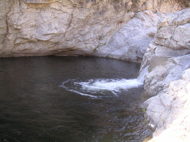
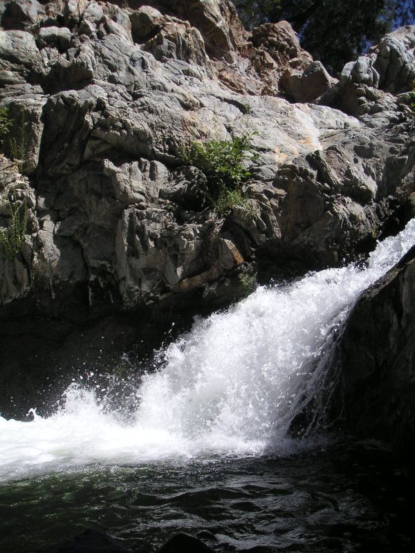
Waterfall, August 2017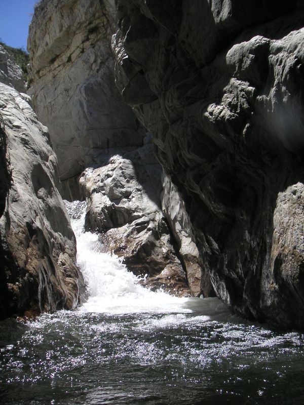
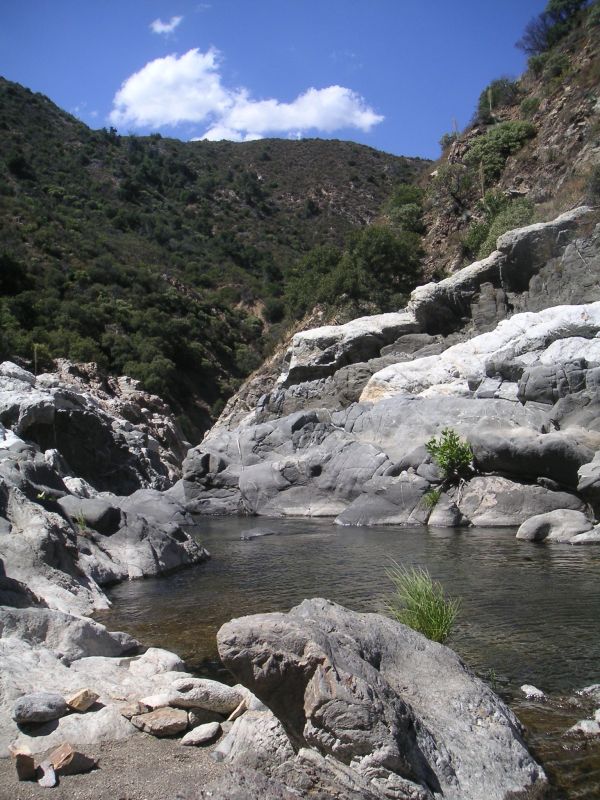
Gorge below waterfall (pool 0), August 2017
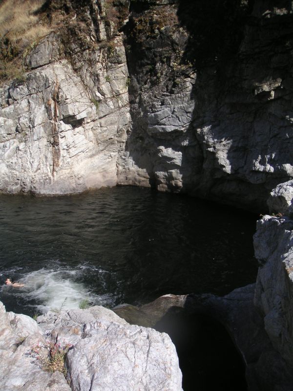
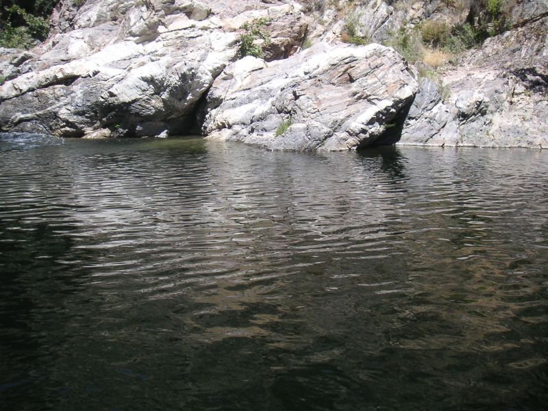
People (not us) were doing backflips into this pool, which we have numbered 5, August 2017
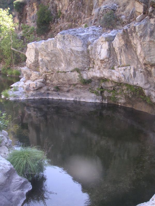
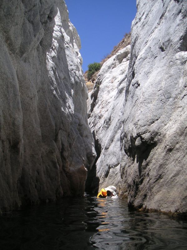
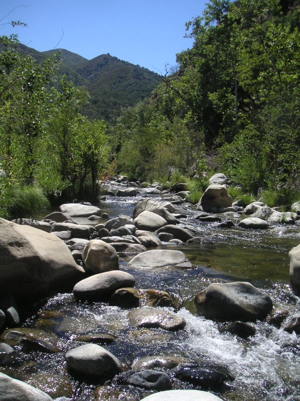
Between pool 5 and the elephants, upstream from the bridge, August 2017
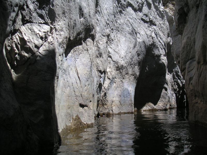
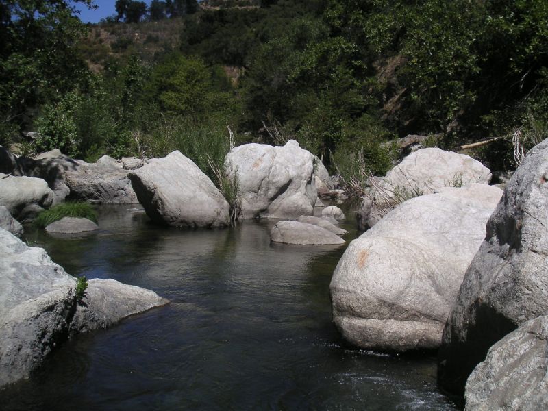
This area we call the elephants, between pool 7 and the horse bridge, August 2017
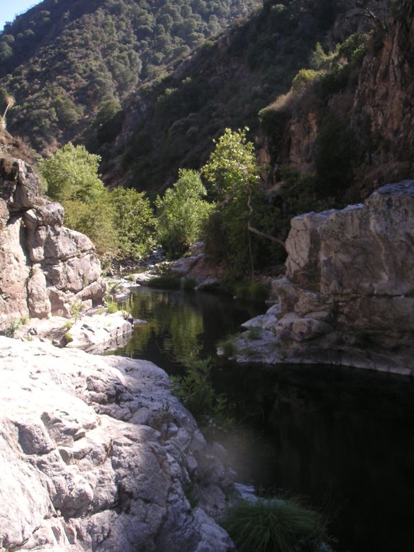
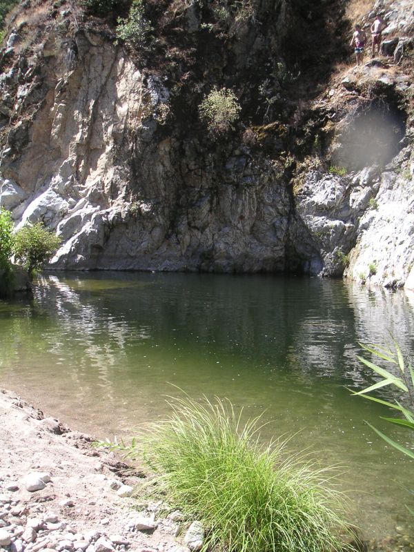
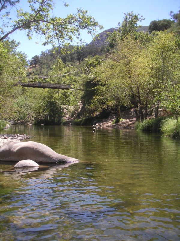
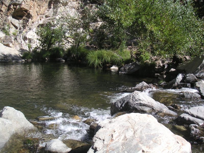
Horse bridge, and pool 8 below, August 2017
This stream joined our river just below the bridge and was noticeably cooler, August 2017
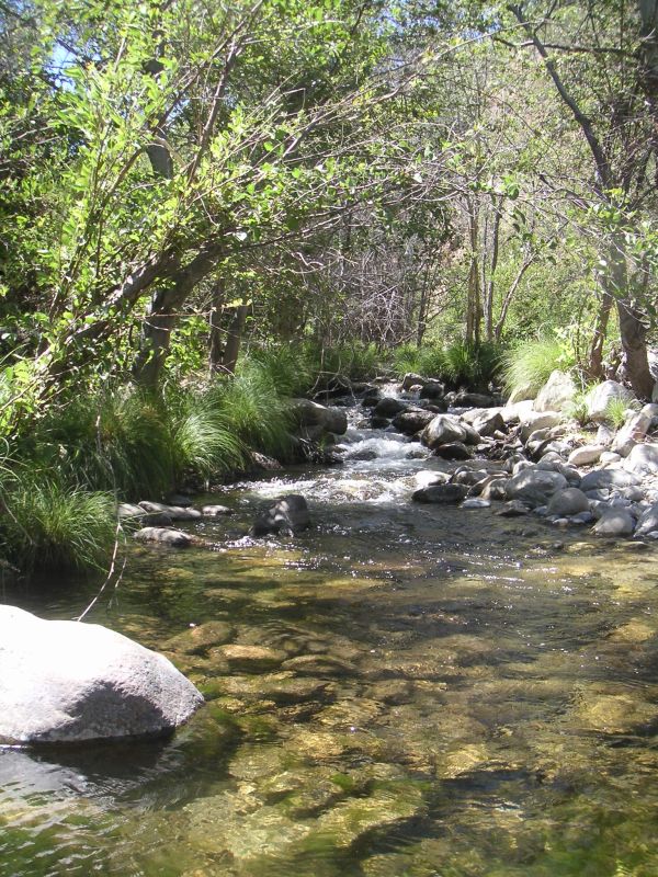
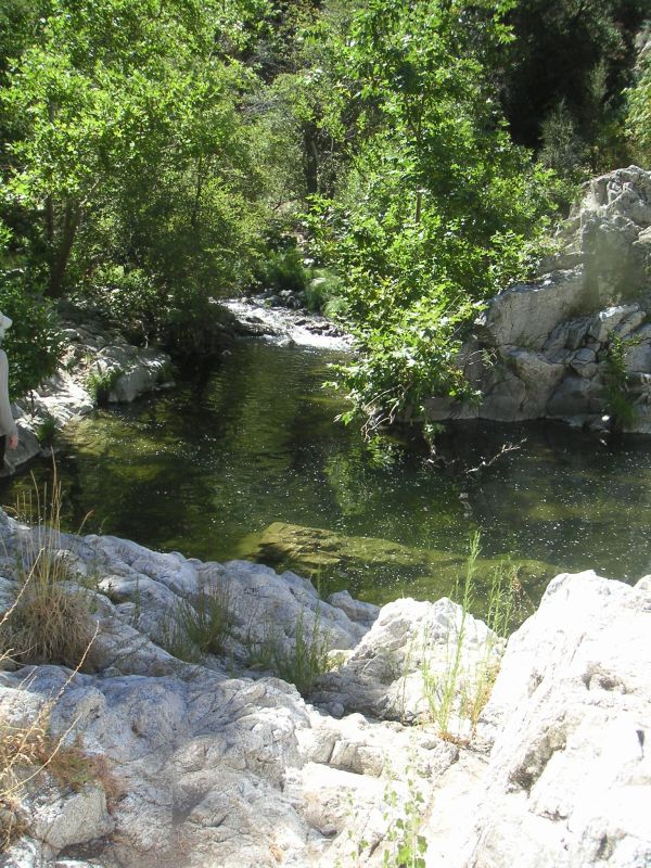
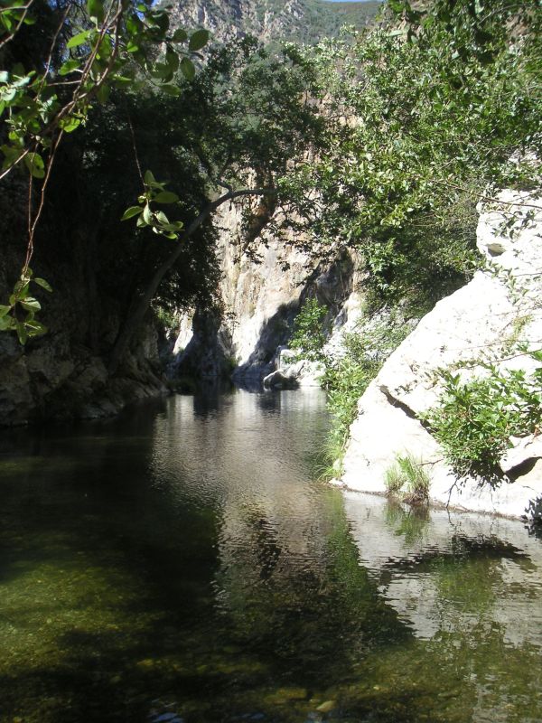
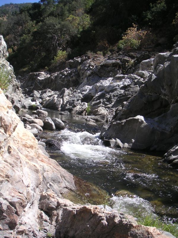
Images downstream from the bridge, August 2017
Somewhere around here is a steep trail up to the fire road after pool 20, August 2017